
 Complete Guide to the Blue Lakes Trail in Colorado:
Introduction:
Located in the heart of the San Juan Mountains, the Blue Lakes Trail offers one of the most scenic hiking experiences in Colorado. The trail is famous for its stunning alpine scenery, turquoise blue lakes and breathtaking views of the surrounding peaks.
Whether you are a seasoned hiker or a nature enthusiast looking for a day of beauty, the Blue Lakes Trail is a must-see. In this guide, we’ll cover everything you need to know to prepare for your adventure, from trail details to how to get there, to what to expect on the hike itself.
Overview of the Blue Lakes Trail: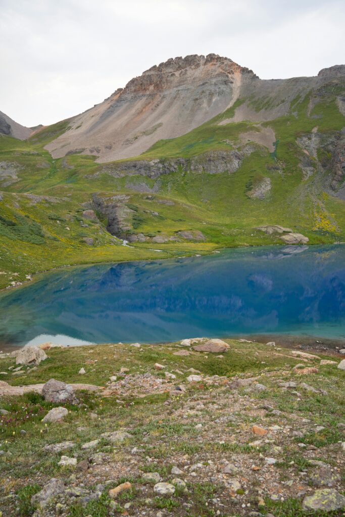
Location: Near Ridgway, Colorado, within the Mount Sneffels Wilderness Area.
Trailhead: Blue Lakes Trailhead (accessible via County Road 7).
Distance: Approximately 8.6 miles round trip to Upper Blue Lake; Add an additional 1.8 miles for a round trip to Blue Lakes Pass.
Elevation Gain: About 2500 feet to Upper Blue Lake; An additional 900 feet to Blue Lakes Pass.
Difficulty: Moderate to hard, depending on fitness level and height adaptation.
Duration: 4-6 hours to Upper Blue Lake, 7-8 hours including Blue Lakes Pass.
Best time to hike: Late June to early October, when the trail is mostly snow-free, and the wildflowers are in bloom.
The Blue Lakes Trail in Colorado is one of our all time favorite day hikes,
Getting to the Blue Lakes Trailhead:
Driving Directions: The Blue Lakes Trailhead is located approximately 45 minutes from Ridgway, Colorado. From Ridgway, take Highway 62 west toward Telluride. Turn left onto County Road 7 (Dallas Creek Road) and follow it for approximately 9 miles until you reach the parking area at the trailhead. The road is rough but passable for most vehicles. However, a high clearance vehicle is recommended, especially after rain.
Parking: The parking area at the trailhead is limited, and fills up quickly during hiking season. Arrive early to secure a spot, especially on weekends. If the parking lot is full, you’ll need to park on the side of the road, which can add some extra distance to your hike
Blue Lakes Trail: 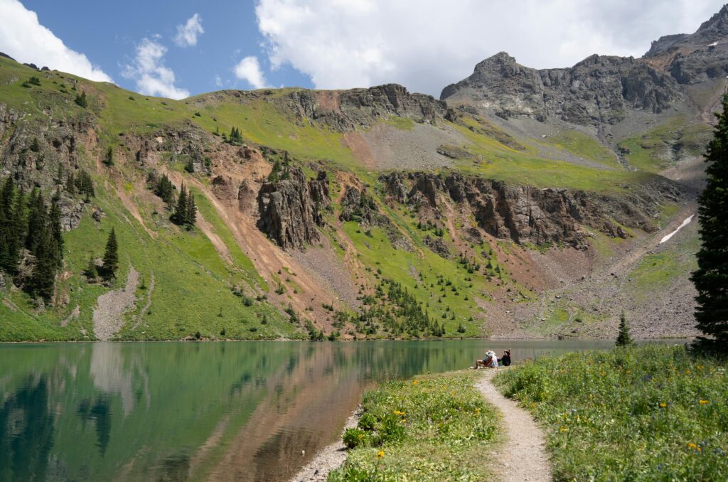
Lower Blue Lake: The hike begins at the Blue Lakes trailhead, where you will immediately enter a lush forest of aspens and evergreens. The trail climbs gradually through thick forests, offering occasional glimpses of the surrounding mountains.
After about 3.5 miles, the forest opens up, revealing the magnificent Lower Blue Lake. The lake, with its vibrant blue-green color, is surrounded by meadows filled with wild flowers during the summer months. It is a perfect place for a break or a picnic.
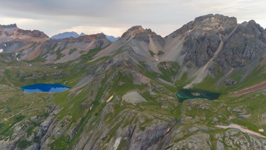
The Blue Lakes Trail in Colorado takes you to 3 different lakes and a beautiful mountain pass. Most people only go to the lower Blue Lake.
This is a very popular trail for day hikers and backpackers, so weekdays are best if you want to avoid the crowds. Many people camp at Lower Blue Lake on summer weekends.
Distance: 3.5 miles
Elevation Gain: 1,600 feet
Time: 1.5 – 2 hours
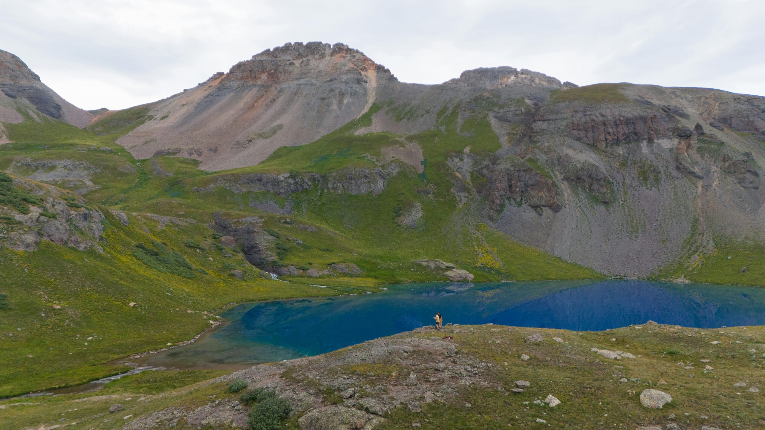
Middle and Upper Blue Lakes: Passing through Lower Blue Lake, the trail gets steeper as you head towards Middle and Upper Blue Lakes. Middle Lake is smaller and less visited but offers beautiful views and solitude. The final push to Upper Blue Lake is the toughest part of the hike, with a series of switchbacks leading to the lake,
The effort is well worth it, as Upper Blue Lake sits in a dramatic cirque below the towering peaks of Mount Sniffles and Dallas Peak. The deep blue color of the water, contrasted with the rocky surroundings, creates an unforgettable scene.
Distance: 0.3 miles
Elevation Gain: 150 feet
Time: 15 minutes
Upper Blue Lake To Blue Lake Pass: For those looking for an even bigger challenge, continue on the trail from Upper Blue Lake past Blue Lakes Pass. This additional 0.9 mile trek (one way) gains another 900 feet of elevation gain, bringing you to an elevation of 13,000 feet.
From here, you’ll be rewarded with sweeping views of the Sneffels Range, Yankee Boy Basin, and beyond. It can be windy on the pass, so bring layers to stay warm.
Distance: 1.5 miles
Elevation Gain: 1,250 feet
Time: 1 hour +
What To Expect?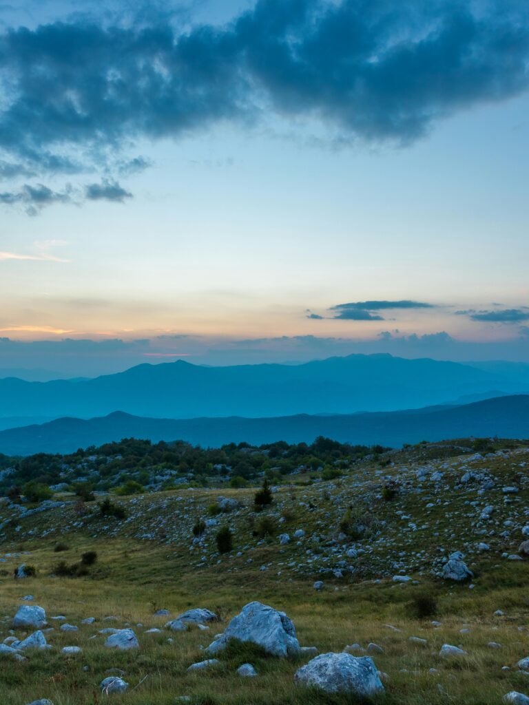
Scenery: The Blue Lakes Trail offers some of the most spectacular alpine scenery in Colorado. In early summer, the meadows around the lakes are bursting with wildflowers, including columbine, Indian paintbrush and lupine.
The lakes themselves are a brilliant shade of blue, thanks to the glacial runoff that feeds them. The surrounding peaks, including Mount Sniffles, create a dramatic backdrop that changes with the changing light throughout the day.
Wildlife: The area is home to a variety of wildlife, including marmots, pikas and deer. If you’re lucky, you might even spot a mountain goat or a black bear. Keep your distance from wildlife, and remember to pack all trash to protect the environment.
Trail Conditions: The trail is well marked and maintained, but can be rocky and rough in places. Early in the season, patches of snow may remain on the trail, especially near Upper Blue Lake and Blue Lakes Pass. Trekking poles and sturdy hiking boots are recommended.
Weather: Weather in the mountains can be unpredictable, so it’s important to be prepared for all conditions. Even in summer, temperatures can drop quickly, especially at higher elevations. Afternoon thunderstorms are common, so start your hike early to avoid getting caught above the tree line during a storm.
Camping At The Blue Lakes: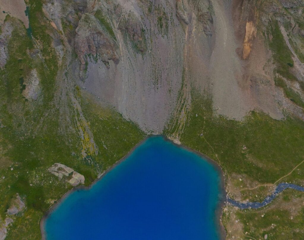
Camping and fishing are possible here, and lower Blue Lake is considered good for cutthroat trout fishing.
There are some great places to camp on the lake, but it gets pretty crowded on weekends. Please remember to pack whatever you pack, and keep the lake at least as clean as you found it. Enjoy!
Packing Tips:
- Hiking Boots: Sturdy, waterproof boots with good ankle support are essential for climbing rocky terrain.
- Layers: Dress in layers to adapt to changing temperatures. Bring a waterproof jacket, a warm fleece or down jacket, and moisture-wicking base layers
- Water and snacks: Bring plenty of water, as there are no reliable water sources along the trail. High-energy snacks such as trail mix, energy bars and fruit are also recommended.
- Sun protection: High altitude means strong UV rays, so wear sunscreen, sunglasses and a wide-brimmed hat.
- Map and Compass/GPS: Although the trail is well marked, it’s always a good idea to bring a map and know how to use it. A GPS device can also be helpful.
- First Aid Kit: A basic first aid kit with bandages, antiseptic and any personal medications is essential.
- Camera: The scenery is spectacular, so don’t forget your camera to capture the beauty of the Blue Lakes.
Tips for a Successful Hike:
- Start early: The trail is popular, so starting early helps you avoid the crowds and gives you more time to enjoy the scenery. It also reduces the risk of getting caught in an afternoon storm.
- Altitude Acclimatization: If you are coming from a low altitude, spend a day or two acclimatizing to the altitude. This will help reduce the risk of altitude sickness.
- Leave No Trace: The Blue Lakes Trail is in a pristine forest area, so it is important to follow the Leave No Trace rules. Pack out all trash, stay on designated trails, and avoid picking wildflowers.
- Respect wildlife: Keep your distance from wildlife, and never feed animals. It helps maintain the natural balance of the ecosystem and keeps both you and the animals safe.
- Check the weather: Always check the weather forecast before your trip. If thunderstorms are forecast, consider rescheduling your trip for another day.
Nearby Attractions:
Ouray: Known as the “Switzerland of America,” Ouray is a charming mountain town just a short drive from the Blue Lakes Trailhead. The city is known for its hot springs, historic architecture, and access to other hiking trails and outdoor activities.
Telluride: This historic mining town turned ski resort offers a wide range of summer activities, including hiking, mountain biking, and festivals. The gondola ride between Telluride and Mountain Village offers spectacular views of the surrounding mountains.
Yankee Boy Basin: Located near the Blue Lakes Trailhead, Yankee Boy Basin is another popular hiking and four-wheel drive destination. The basin is famous for its wildflowers, waterfalls and views of Mount Sniffles.
Trailhead For Blue Lakes: How To Get There: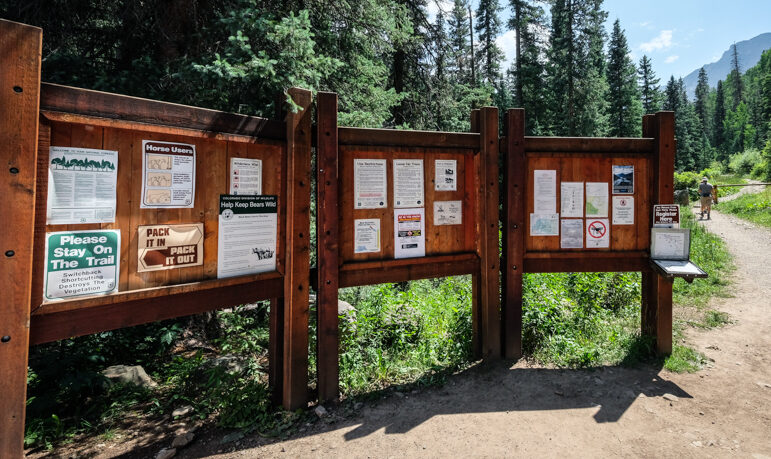
The Blue Lakes Trailhead is located 45 minutes from Ridgway, Colorado. To get there, drive west on Highway 62 toward Telluride, then turn left onto County Road 7 (Dallas Creek Road). Follow this dirt road for about 9 miles until you reach the trailhead parking area.
The road is rough, so a high clearance vehicle is recommended, especially after rain. Arrive early to secure a parking spot, as lots fill up quickly during hiking season. If full, you may need to park on the side of the road, adding some distance to your walk.
It is also possible to do this hike in reverse, starting from the south trailhead at Yankee Boy Basin, but this route is probably not ideal for most hikers because it is difficult to visit the popular Lower Blue Lake.
Conclusion
The Blue Lakes Trail in Colorado is a gem for anyone who wants to experience the natural beauty of the Rocky Mountains. With its stunning lakes, diverse wildlife, and challenging terrain, it offers something for every hiker.
Whether you’re looking for a peaceful day hike or a more strenuous adventure to Blue Lakes Pass, this trail offers an unforgettable experience. Remember to prepare properly, respect the environment, and take time to soak in the breathtaking scenery. Happy hiking!
Don’t forget to check out my other Travel guides before you go!
Thanks for looking! I hope you enjoyed this guide to the Blue Lakes Trail near Ridgway, Colorado.